Pilgrimage Paths
There are 13 pilgrimage routes to the Villa and Puebla de Santa María de Guadalupe. All the information about them can be found in the attached links and on the official website of Caminos a Guadalupe. On this website you will have more information about each path, topographic maps as well as the official tracks to be able to follow the pilgrimage routes using GPS.
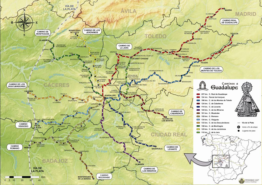
Información detallada de cada camino
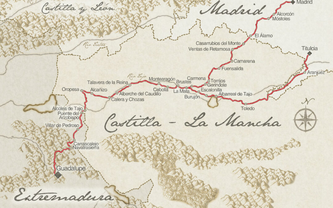
Royal Path from Madrid
Caminantes de ayer y de hoy
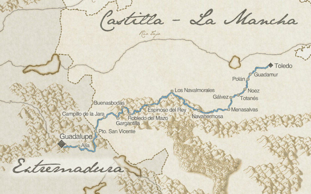
Path of the Montes de Toledo
Camino Heredero de la antigua calzada que unía la antigua Toletum con Emérita Augusta
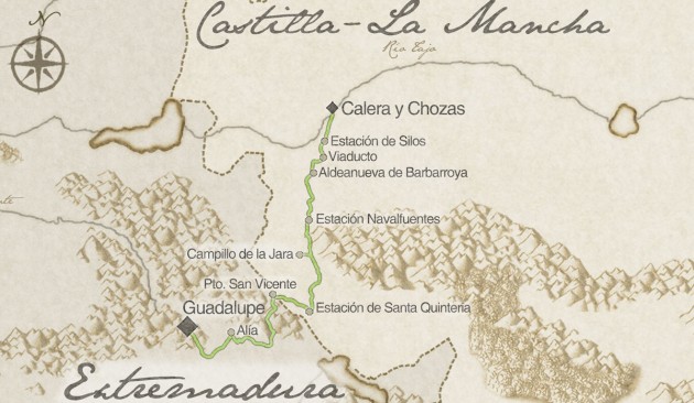
Path to JARA (Cistus plant)
Un viaje muy natural
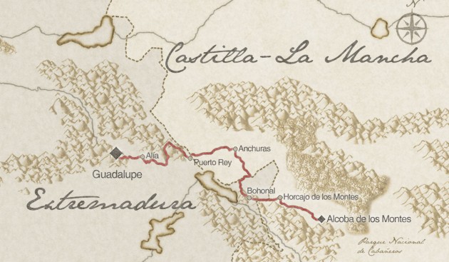
Cabañeros Road
Una ruta Segura
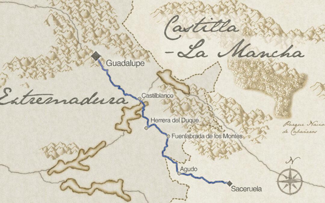
East path
Caminando hacia poniente
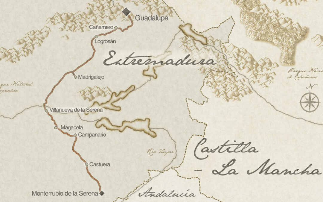
Mozarabic Road
El fecundo contacto cultural entre cristianos y musulmanes
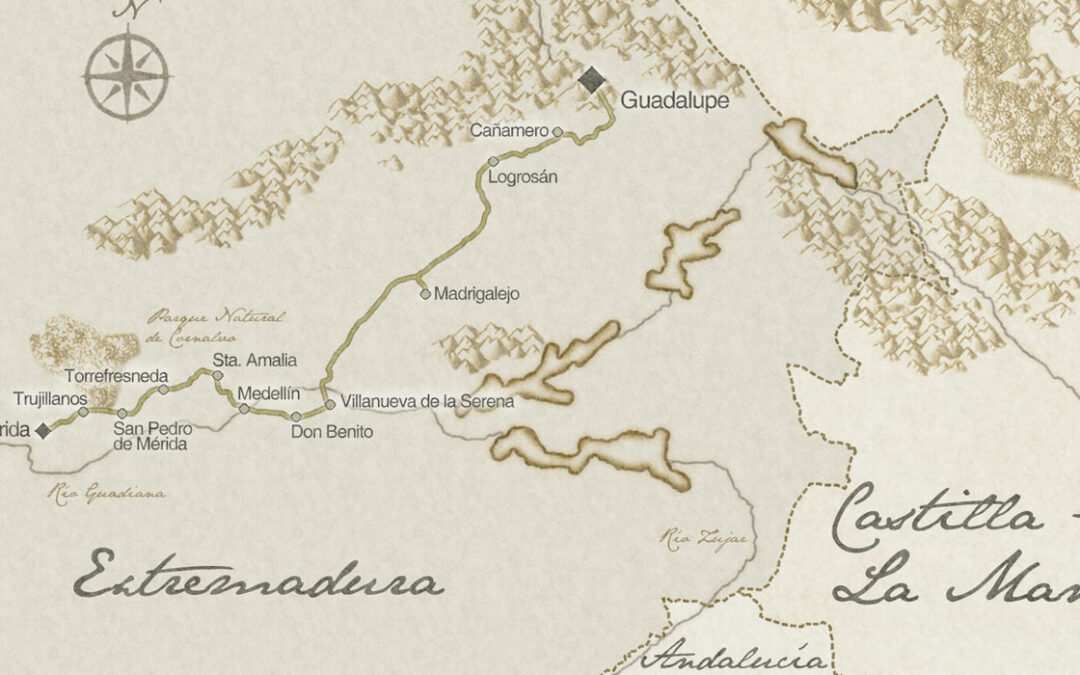
Roman Road
Heredero de la antigua calzada romana que une Mérida con Toletum (Toledo)
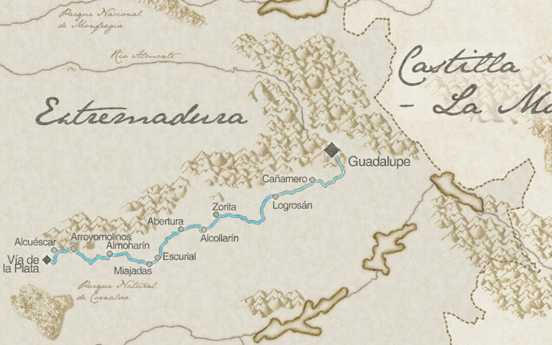
Visigoth Road
El legado visigodo en Extremadura
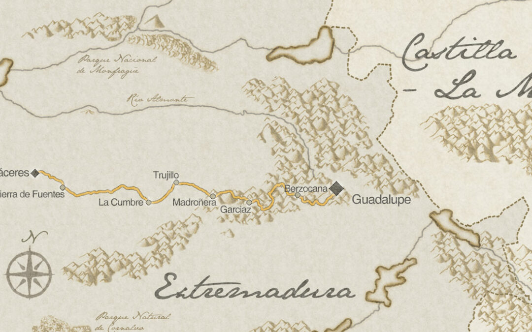
Discoverers Road
Guadalupe y el nuevo mundo
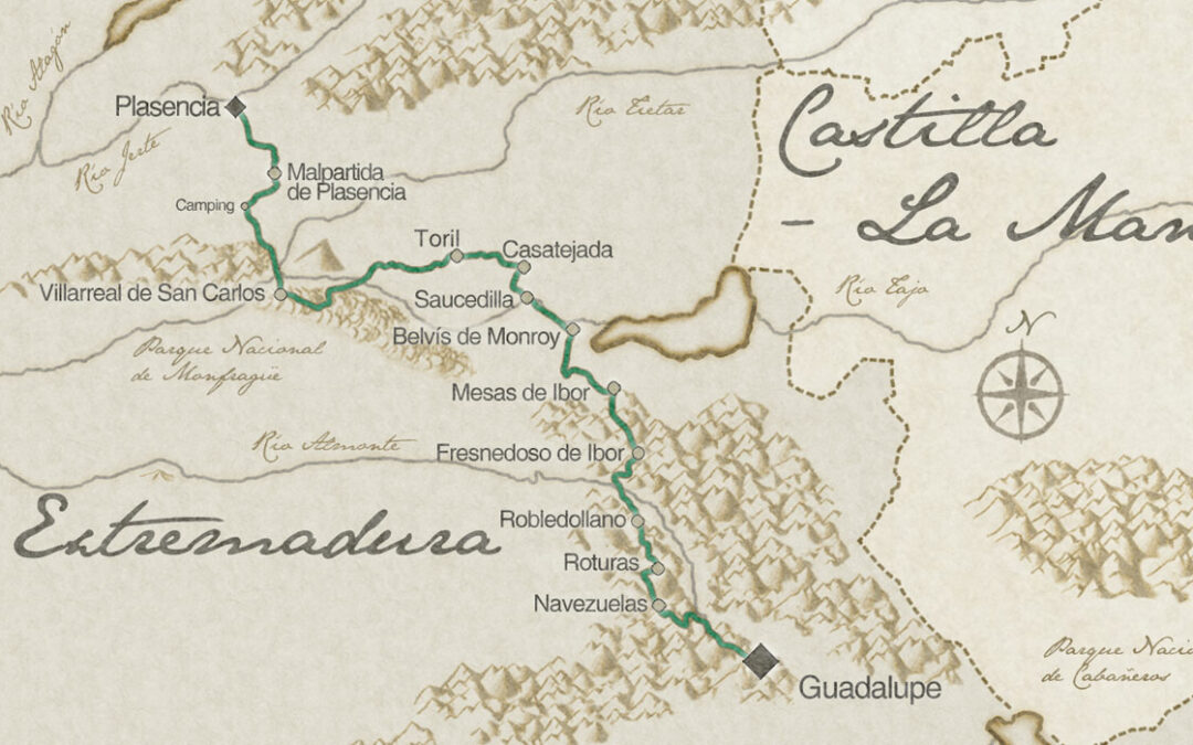
Monfrague Road
Valores naturales, patrimonio artístico, histórico y cultural
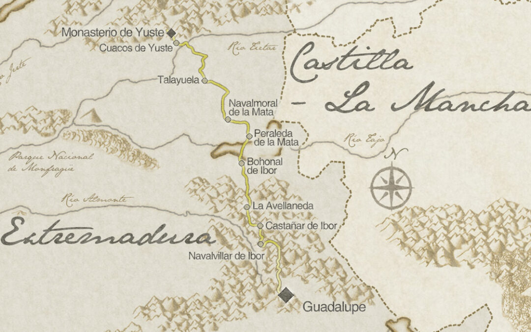
Jeronimos Road
Un itinerario entre dos de los de los monasterios mas importantes de la orden jerónima
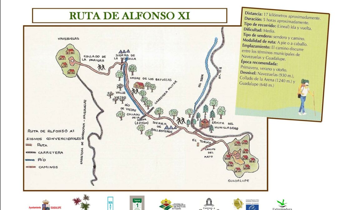
Route of Alfonso XI
This time we start from the town of Navezuelas, through which the Almonte River passes. We will take an old path that preserves some cobbled sections. Ascending, we leave the Carpintero peak (1,271 m) to the right until we reach the Collado de la Pariera (1,240 m),...
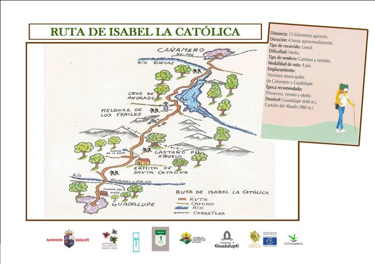
Route of Isabella the Catholic
The route runs between the towns of Cañamero and Guadalupe, crossing different and varied ecosystems that give it a special attraction. The trail starts right in front of the Hotel Ruiz de Cañamero and begins to go down towards the river Ruecas, where on the right...
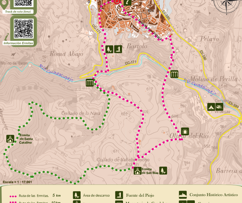
Route of the Hermitages
We will start the route from the Plaza de Sta. María de Guadalupe in the direction of Calle Gregorio López. We will continue along Calle Poeta Angel Marina and Avda. Juan Pablo II. At its end we will find a dirt road on the right, where we will begin the descent...
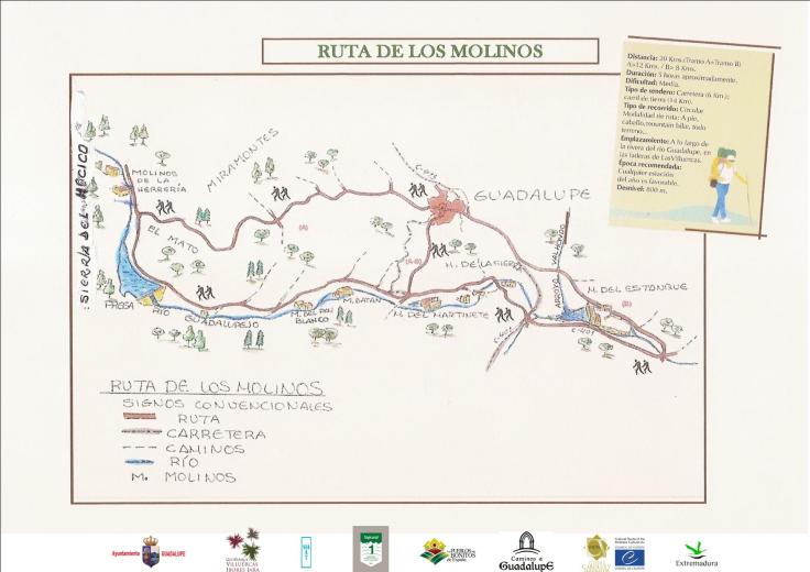
Route of the Mills
Starting from the Plaza Mayor, we will head towards the neighborhood of La Cantera or San José Obrero, through Nueva, Corredera and Cantera streets. We can also access the neighborhood through Avda. Alfonso XI and Molino de San Jerónimo street. Once past the Municipal...
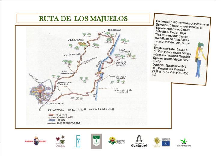
Route of the Majuelos
We begin the route starting from the Plaza de Santa María de Guadalupe through the streets Gregorio López, Poeta Ángel Marina, Calvario and Plazuela de San Francisco, to cross the EX-118 highway, the threshing camino, to go down to the river, leaving to the right the...
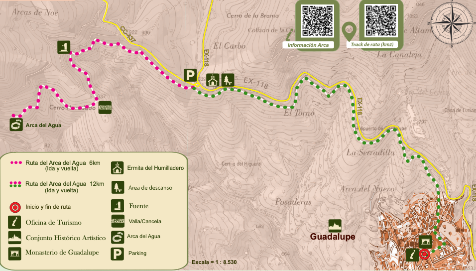
Route of the Water Ark
Starting from the Plaza de Santa María de Guadalupe we go to Caño de Abajo street, where there is a rectangular-shaped fountain that supplied this neighborhood, known as the Fuente del Caño: we will continue along Matorral street and the old pilgrims’ path who came...
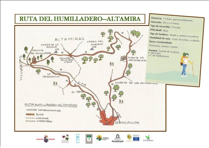
Altamira Humilladero Route
We start from the Plaza de Santa María de Guadalupe ascending Calle Marqués de la Romana; then we turn left on Calle Nueva, we go up Calle Real until we reach Calle Caño de Abajo and Calle Matorral. From this point we ascend to the hermitage of Humilladero along the...
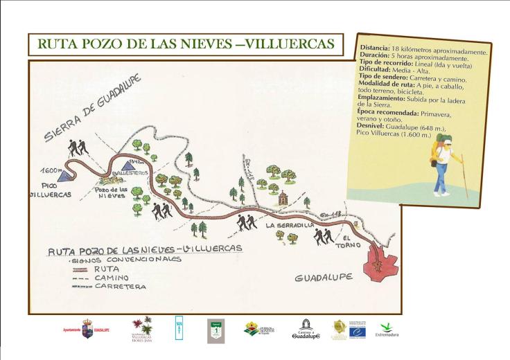
Pozo de las Nieves-Villuercas Route
Comenzamos la ruta en coche accediendo por la carretera que nos lleva desde Guadalupe hasta We begin the route by car accessing the road that takes us from Guadalupe to Navalmoral de la Mata (EX-118) or walking along the left path that runs parallel to this road and...
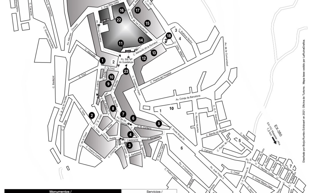
Self-guided route through Guadalupe
Conoce con esta guía los principales puntos de atracción turística de Guadalupe
